|
|
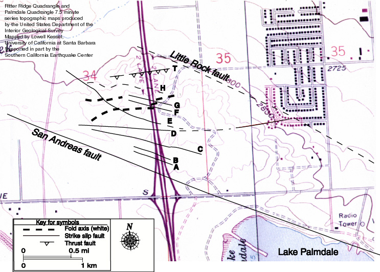
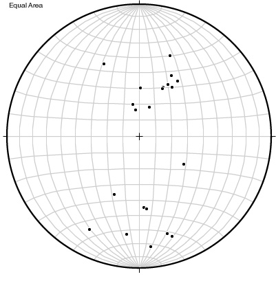
Obtained from the Ritter Ridge Quadrangle and the Palmdale Quadrangle 7.5 minute series topographic maps produced by the United States Department of the Interior Geological Survey. Faults A, B, C, F, and G are parallel to the SAF. Faults D and H are oriented approximately 20°-22° to the strike of the SAF and because of their orientation are inferred to Riedel shears. Fault I is a thrust fault oriented 30° to the strike of the SAF. Fault E is a fold accommodation fracture, and its displacement is likely contemporaneous with the folding. Fault D may actually be a fracture that resulted from simple shear coupling of both the SAF and the LRF. The folds located in the center of the road cut are mapped on the topographic map shown above. The fold axis for the folds trend approximately east west. The orientation of the folds is supported by strike and dip measurements of the limbs of the folds. The poles to the planes are plotted on an equal area stereo-net shown below and show a north south trend, which is 90 degrees to the actual trend of the folds. The large folds shown on the main page are offset by faults E, F, and G and suggests that the folds formed prior to the faults. This is what would be anticipated because the rocks can deform a little before they break or fracture. The folds orientation and temporal relationship to the faults suggest that they were formed by simple shear related to the SAF and not coupling of the SAF and the Little Rock fault (LRF). |
 |